Maybe I should change the name of this blog to 'Londonbackpacker's non-walking pages' as I haven't done any real walking since September. :(
Although I have been urban walking, four weeks ago my scooter broke down and I`ve spend the last four weeks trying to get a part for it, only to be told today that there is a shortage of the part and I will have to wait until the new year.
I`ve been walking about 1 1/2 miles a day to work for the past four week. Not great mileages; I know but it's more than I was doing.
Although it doesn't seem to be making me any fitter or lighter, admitedly the walk is broken down into two parts with a bus journey in the middle.
The bus journey amazes me with the people who use it. Every morning the same person gets the same bus with me and travels to the next stop, if the bus is late they wait for it the same as me, but the really amazing thing is that the next bus stop is only 300 or 400 yards away.
Surely they can walk this!!!!!!!!!!!!
No wonder we're turning into a nation of fatties.
Anyways enough moaning from me :)
Merry Christmas and a happy New Year to anyone who is still reading.
Friday, 22 December 2006
Saturday, 2 December 2006
New Blogger
Seems like I`ve been neglecting my blog :(.
True be told, I haven't had much to say (write) anything and I`ve been really busy at work and not a lot of time for the internet.
While I`ve been away a new UK walking blogger have appeared.
Weird Darren (of OM fame) has a new site. Darren's blog is mainly about his preparation for his up and coming TGO challenge.
Friday, 27 October 2006
Thursday, 19 October 2006
Another one found (blogger that is)
Another U.K blogger has appeared on the scene.
This time it's Alan Sloman's Big Walk
Alan will be setting off in March '07 to walk from Land's End to John O'Groats; some 1600 miles!
This time it's Alan Sloman's Big Walk
Alan will be setting off in March '07 to walk from Land's End to John O'Groats; some 1600 miles!
Monday, 16 October 2006
Digital Technology
In the past few years digital technology has really been a big help to walkers & hikers.
With the avent of the internet, we have been able to find out so much more information, throught the likes of dedicated websites such as walking forums, people's personal blogs and most recently podcasts.
We are also able to obtain equipment from virtually anywhere in the world (even if we do get clobbed with import taxes!!).
Digital cameras have given us the ability to have instant pictures, no more waiting a week for the prints to come back from the chemist and then being disappointed and wishing you could go back and try to capture the picture again (or is that just me).
Handheld GPS's are another way that digital technology is helping us, by being able to put us within a couple of metres of where we want to be, anywhere in the world.
The biggest piece of digital technology I have found useful are digital maps.
In the past; I would have to lay a map out across the kitchen table and then try to map out a route, use a map measurer to work out the distances covered. One area I could never work out was total ascent and decents mainly because I found it just to difficult.
Now with digital maps; I can plot a route on screen, I can change it and not have to re-measure the distance. I can check the total ascent & descent with the click of the mouse.
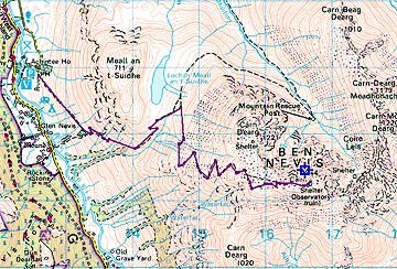
ROUTE:Car park to the top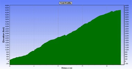
Profile
I don't have the problem where a route will go onto another map which I don't have, as digital maps are seamless. I also have the ability to save the routes and then download them into a GPS.
There are some drawbacks with digital maps, they are expensive (but in the long run you do save money). You can't buy the whole country in 1:25000, so it has to be 1:50000 but you can print out at different scales ranging form 1:1000000 to 1:10000, although the best scaling are either 1:50000, 1:25334 or 1:25000 but all the scalings are only enlargements of the 1:50000.
Another problem is that you can only print up to A4 in size.
Apart from these few small problems, digital maps are definitely the way to go.
Sunday, 8 October 2006
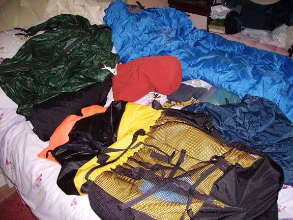
Gear used on Dorset trip
I thought I give a run down on the equipment I used on the recent trip to Dorset and how well it worked.
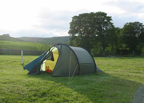
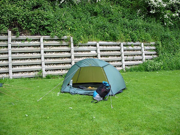
Tent
Terra Nova Solar. This is my favourite tent, more than enough room for one. Planty of porch space and headroom, I can sit up without worrying about my head touching the inner.
Best of all in the way that the porch doorway can be opened and give great views outside.
Backpack
Sixmoondesigns Comet. This pack has now replaced my G4, this a similar design and the three big pockets easily contain everything I need during the day, so I don't need to go into the inside of the pack.
Sleeping Bag
F&T Rolling Clouds 300 down bag. This is only the second trip I`ve used this bag on but so far its performed really well. It weighs just over 800 gms and although I never compress my bags it doesn't take up much room in my pack.
Sleeping Mat
This is one area where I made a mistake for the trip. As this was he first trip out since May, I decided to try a keep the weight down and decide to use my Artiach 3/4 length sleeping mat. The length of the mat wasn't a problem but I could feel the hard ground on my hips through it. In future I with be using my Isulmat Max-Thermo . It's heavier but I always get a good nights sleep on it.
Cooking Kit
My cooking kit consists of a Pocket Rocket Stove, 1 lexan spoon & fork, 2 non-stick pots (althought on this trip I only took one and regreted it), tin foil (to make a lid for the pots) and a plastic mug. The gas canister was a 100.
Other Kit
First Aid kit
Wash Kit
Waterproof jacket & trousers
T-A-R pillow
Spare socks & pants
Monatne windshirt
Fleece
Tikka Torch
1L platypus
Camera
Leki Poles
One other piece of equipment I didn't take on this trip was a MP3 player, which again I regreted.
All of this added up to 8.5 kg, without food and water.
Sometimes I think I get paranoid about the items and the weight I carry. Sometimes carrying the lighter equipment means I`m uncomfortable around camp.
If I was walking 20 mile days I probably find carrying the extra weight a problem but I never walk more than 15 miles, so I think the extra comfort in camp is better for me.
Saturday, 7 October 2006
Picture problems again
Blooger seems to be having problems when uploading pictures again :(
I`ve uploaded my pictures for the previous entry to Imageshack
This seems to work O.K but you do need to make sure the pictures are not wider than 5 in or it distorts the page.
I`ve uploaded my pictures for the previous entry to Imageshack
This seems to work O.K but you do need to make sure the pictures are not wider than 5 in or it distorts the page.
Two go camping in Dorset
3 1/2 days in Dorset
27th-30th September 2006
Hikers: Peter & George
Day One
Distance: 9.1 miles
High Ascended: 1194 ft
The trip was similar to one we did a couple of years ago following the
Purbeck Way. We started in Ridge just outside of Wareham.
We arrived about 5 pm on Wenesday and set-up the tents straight away. We then started on the wine :)
We woke to overcast skies and the forecast of rain, so we had a quick breakfast and packed up.
100 yards down the road and the rains started so it was on with the waterproofs and ready for a day of rain.
Luckily by the time we got to Stoborough Green the rain stopped and the Sun and blue skies re-appeared.
The walking was pretty easy on both the eye and the feet, as the terrain is open heathland.
Me on Creech Heath

Within a couple of hours we were in Corfe Village and made our way straight to the village bakery, in the bakery window was a notice proclaiming '3 bacon rashers in a bap £1.80' both Peter and I thought that would make a nice mid-morning snack.
Unfortunately they only had 3 rashers left but Peter could see I was flagging in a big way and allowed my to have them :) (Thanks Peter).
After our brunch stop, we made our way out of Corfe and up onto East hill.
Corfe Village from East Hill


Corfe Castle
Once we were up on the ridge of Challow Hill,Bollington Hill and Brenscombe Hill we had brilliant view back down to Corfe and over to Studland & Poole.

Studland & Poole
At Brenscombe Hill we decided that it was time for another Brew :)

Peter's tea break
From here we dropped down to Harman's Cross, where I nearly got run over. I was trying to get a picture of the steam train leaving Harman's Cross Station and going under the bridge and as the steam from the engine came up I stepped back into the path of a car, luckily he saw me and stopped.
From here we made out way the short distance to Woodyhyde Farm for our night's camp.
Day Two
Distance: 12.3 miles
High Ascended: 1960 ft
After a very rainy night; we woke to more rain. Today we were aiming for Tom's Field in Langton which as the crow flys is about 1 1/2 miles from Woodyhyde but we were going to do a big circuit.
As the weather was poor and still raining we don't start until 9.30 am. Out route for today was back to Harman's Cross and back onto the ridge, but because of the rain we decided to stay on the lower path of Ailwood Down. After about an hour's walking the rain stopped and the Sun was out, so off came the waterproofs.
We followed the path down to the road near Ulwell and then climb up to the Obelisk on Studalnd Hill and followed the ridge across to Ballard Cliff. All the while the weather was quite good and we had views downs to Studland and Swanage and across to the Isle of Wight. As we desended down Ballard Cliff the weather started to turn again so it was a rush to get into Swanage before the rain came again.
There is a point where the coatal path reaches the beach but the path continues up into the outskirts of Swanage and this is a plod into the town centre. This time we took to the beach and within 10 minutes were in the centre of town.
We made our way to somerfield s for lunch and then found a shelter to sit and eat it in. We also got our stoves out for a brew, which seemed to amuse the passers by.
By now the rain had set in again and the route around Durlston bay and Durlston Head didn't look to appealing. So we looked for an alternative route, we found one which went up through the town and then out to the open countryside.
The only problem with these routes through towns and housing estates, is that you get disorienated and lost :( After tramping around different allyways and small footpaths we finally found ourselves on the main road up to Durlston Head (Grrrr!!!).
We then made our way out to the lighthouse at Anvil point. As we have done parts of this route before and especially the coastal path, we stayed on the highier path and followed this before turning in land again to Langton and Tom's field.
Day Three
Distance: 9.1 miles
High Ascended: 726 ft
The Backpacker Club were having a static club meet at Tom's field for the weekend, so we said welcome to the members that were already there, and a few turned up as the night went on. One of the biggest disturbancies of the night was a group of ATC turning up and making a right royal racket. They also had one of the biggest tents I`ve ever seen, it was a khyam dome tent called the megatop.
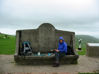
After another poor night, we were up and away by 8.00 am. The route back today was following a couple of the paths we had already crossed. We made our way NE to Woodyhyde and picked up a path back into Corfe Village, where Peter was hoping to get his Bacon Bap today (unfortunately the Bakery didn't cook on a Saturday).

Peter without his Bacon Bap
From Corfe we took the path out over Knowle Hill and down to East Creech.

View from Knowle Hill
From there it was a couple of miles back through Furzebrook and Stoborough Heath to the campsite at Ridge.
27th-30th September 2006
Hikers: Peter & George
Day One
Distance: 9.1 miles
High Ascended: 1194 ft
The trip was similar to one we did a couple of years ago following the
Purbeck Way. We started in Ridge just outside of Wareham.
We arrived about 5 pm on Wenesday and set-up the tents straight away. We then started on the wine :)
We woke to overcast skies and the forecast of rain, so we had a quick breakfast and packed up.
100 yards down the road and the rains started so it was on with the waterproofs and ready for a day of rain.
Luckily by the time we got to Stoborough Green the rain stopped and the Sun and blue skies re-appeared.
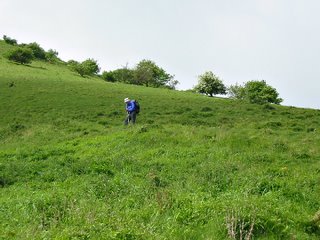
The walking was pretty easy on both the eye and the feet, as the terrain is open heathland.
Me on Creech Heath
Within a couple of hours we were in Corfe Village and made our way straight to the village bakery, in the bakery window was a notice proclaiming '3 bacon rashers in a bap £1.80' both Peter and I thought that would make a nice mid-morning snack.
Unfortunately they only had 3 rashers left but Peter could see I was flagging in a big way and allowed my to have them :) (Thanks Peter).
After our brunch stop, we made our way out of Corfe and up onto East hill.
Corfe Village from East Hill
Corfe Castle
Once we were up on the ridge of Challow Hill,Bollington Hill and Brenscombe Hill we had brilliant view back down to Corfe and over to Studland & Poole.
Studland & Poole
At Brenscombe Hill we decided that it was time for another Brew :)
Peter's tea break
From here we dropped down to Harman's Cross, where I nearly got run over. I was trying to get a picture of the steam train leaving Harman's Cross Station and going under the bridge and as the steam from the engine came up I stepped back into the path of a car, luckily he saw me and stopped.
From here we made out way the short distance to Woodyhyde Farm for our night's camp.
Day Two
Distance: 12.3 miles
High Ascended: 1960 ft
After a very rainy night; we woke to more rain. Today we were aiming for Tom's Field in Langton which as the crow flys is about 1 1/2 miles from Woodyhyde but we were going to do a big circuit.
As the weather was poor and still raining we don't start until 9.30 am. Out route for today was back to Harman's Cross and back onto the ridge, but because of the rain we decided to stay on the lower path of Ailwood Down. After about an hour's walking the rain stopped and the Sun was out, so off came the waterproofs.
We followed the path down to the road near Ulwell and then climb up to the Obelisk on Studalnd Hill and followed the ridge across to Ballard Cliff. All the while the weather was quite good and we had views downs to Studland and Swanage and across to the Isle of Wight. As we desended down Ballard Cliff the weather started to turn again so it was a rush to get into Swanage before the rain came again.
There is a point where the coatal path reaches the beach but the path continues up into the outskirts of Swanage and this is a plod into the town centre. This time we took to the beach and within 10 minutes were in the centre of town.
We made our way to somerfield s for lunch and then found a shelter to sit and eat it in. We also got our stoves out for a brew, which seemed to amuse the passers by.
By now the rain had set in again and the route around Durlston bay and Durlston Head didn't look to appealing. So we looked for an alternative route, we found one which went up through the town and then out to the open countryside.
The only problem with these routes through towns and housing estates, is that you get disorienated and lost :( After tramping around different allyways and small footpaths we finally found ourselves on the main road up to Durlston Head (Grrrr!!!).
We then made our way out to the lighthouse at Anvil point. As we have done parts of this route before and especially the coastal path, we stayed on the highier path and followed this before turning in land again to Langton and Tom's field.
Day Three
Distance: 9.1 miles
High Ascended: 726 ft
The Backpacker Club were having a static club meet at Tom's field for the weekend, so we said welcome to the members that were already there, and a few turned up as the night went on. One of the biggest disturbancies of the night was a group of ATC turning up and making a right royal racket. They also had one of the biggest tents I`ve ever seen, it was a khyam dome tent called the megatop.
After another poor night, we were up and away by 8.00 am. The route back today was following a couple of the paths we had already crossed. We made our way NE to Woodyhyde and picked up a path back into Corfe Village, where Peter was hoping to get his Bacon Bap today (unfortunately the Bakery didn't cook on a Saturday).
Peter without his Bacon Bap
From Corfe we took the path out over Knowle Hill and down to East Creech.
View from Knowle Hill
From there it was a couple of miles back through Furzebrook and Stoborough Heath to the campsite at Ridge.
Two New Blogs
While I`ve been away, two new hiking blogs have appeared.
The first is Aktoman who is based in Scotland and has a Hilleberg Akto.
Like most of us, he seems to by a gear freak and has reviews of some of the new pieces of equipment he has bought.
The second one is Hike Wales.
This blog has information on hikes in Wales and equipment.
The first is Aktoman who is based in Scotland and has a Hilleberg Akto.
Like most of us, he seems to by a gear freak and has reviews of some of the new pieces of equipment he has bought.
The second one is Hike Wales.
This blog has information on hikes in Wales and equipment.
Tuesday, 26 September 2006
Funny Year
Its been a funny year for backpacking. I`ve only managed one trip so far this year and as we're at the end of September, I don't see to much chance of more this year.
Although I am getting my gear together for a last trip of the year. Four days in Dorset :).
Hopefully the weather will stay reasonable good. This trip also gives me a chance to meet up with the some members from the Backpackers Club, who are having a weekend meet at Tom's Field near Swanage.

Sorting out the equipment
Look out for 'Two go hiking in Dorset'
Although I am getting my gear together for a last trip of the year. Four days in Dorset :).
Hopefully the weather will stay reasonable good. This trip also gives me a chance to meet up with the some members from the Backpackers Club, who are having a weekend meet at Tom's Field near Swanage.
Sorting out the equipment
Look out for 'Two go hiking in Dorset'
Monday, 4 September 2006
Sunday, 3 September 2006
Tents
Back when I started backpacking a tent weighing 2.5kg was considered lightweight.
My first backpacking tent was a Litchfield Viper2; this tent was a 2-person ridge tent with an A-pole system and weighed 3kg.
I only ever used this tent once on a backpacking weekend on the South Downs.
On this trip I saw two tents that work shape my backpacking for the next few years.
The first was the Hilleberg Nallo2 and the other was the Phoenix Phreeranger.
 Phoenix Phreeranger
This tent only weighed 1.8kg and in the early 80's was state of the art. It was a 2-skin design and pitched outer first with the inner being hung inside. Between the inner and outer there was plenty of room for cooking and storing equipment, the inner had a kind of 'V' shape to it and this also gave room the store gear inside.
I used this tent in the Lake District, Wales, the Peaks and most of Southern England over the next 10 years or so. I finaly stopped using it when the PU coating on the flysheet had total disappeared.
By now Phoenix had been bought out by another company and the tent wasn't being made anymore, so it was time to look for another make of tent.
Also by now, I had children so I was looking to get something cheap. Big Mistake!!!
The first of many cheap tents was the Coleman Cobra2. This was a 2-person tent weighing 2.3kg and the inner was made with mesh, which was fine in the Summer but not in the Winter. Once in the Peaks and once on the South Downs I froze, my wotsits off.
Coleman Cobra2
The next tent bought was the Vango micro 100. This was another tent that pitched outer first. The biggest problem with is one was that, there wasn't enough room in the porch to cook without the flysheet being left open and then wasn't a great deal of room in the inner, but it did weigh only 1.6 kg.

Vango Micro 100
My next tent was the Hilleberg Nallo2. This is probably the best 2-person tent made.
There is plenty of room for gear in the porch area and if used solo it like a palace.
It does have some drawback though; because it pitches outer first, you can leave the inner attached but this makes it a big bulk to go in the pack and if the flysheet is wet, it tends to make the inner wet too.
Although the tent only weighs 2kg which is great for a 2-person tent, the flysheet is bulky too. I`ve never had any problems in windy conditions other than it can be a bit noisy. It's also the best winter tent.
Hilleberg Nallo2
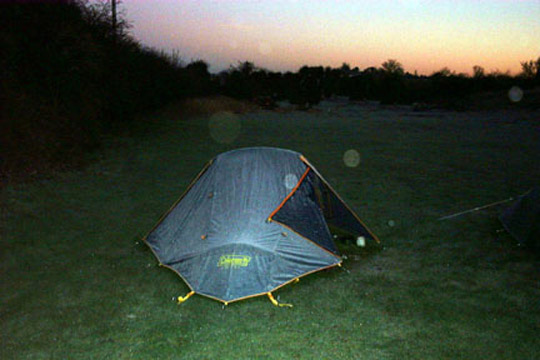
The final tent (for now) is the Terra Nova Solar. This goes back to the single pole design but inner pitching first and weighs in at 1.95kg
There is plenty of room inside the tent and also in the porch area. One of the bestest things I like about this tent is the large door opening. I mainly use this in the summer and it's nice to have the door door early in the morning and watch the sun come up.
Terra Nova Solar
There are plenty of new lightweight tents on the market and probably more to come, but its not just about having the lightest tent, its also being comfortable within that tent.
Thursday, 31 August 2006
Tuesday, 29 August 2006
Packs Part 2
Yesterday I posted about 4 lightweight packs that I own.
Here is a short video showing 3 of the 4; namely the G4,GoLite Trek and the Sixmoondesigns Comet.
I didn't realise how difficult to was to make a video blog, what with aeroplanes going over and cars driving by.
I had to re-record the audio for the first part but hopefully it is all audible and makes sense.
Monday, 28 August 2006
Going Light (packs)
Ever since 2001, after carrying 30/35 lb on the West Highland Way. I have been trying to reduce my pack weight.
On that trip the heavest items were a Karrimor Cougar pack which weighed 6 lb, a Hilleberg Nallo2 tent 4 1/2 lb, a Coleman sleeping bag 3 lb and a sleeping mat 1lb.
All this added up to 14 1/2 lb before cooking equipment, extra clothes, food & water.
Although I managed to carry all this, at the end of each day I was totally knackered!
After this trip I decided that if I wished to contiune backpacking I would need to lost a lot of weight from my pack.
Around this time; GoLite were starting to be seen in the U.K. So I bought a GoLite Gust pack. This pack weighed in at 1 1/4 lb, a big saving of 4 3/4 lb on the Cougar!!
Although it was a big weight saving it did have a few drawbacks, like only one small pocke on the front and no top lid pocket. My thoughts on the Gust can be read on BGT
About 3 months later, I got the chance to test the GoLite Trek pack.
This was more like a traditional pack with a top lid pocket and pockets on the front a sides. Again more on my thoughts on the Trek are at BGT
After testing the Trek, a friend offered to make me a G4. The G4 weighs around 1.1 lb. This pack is quite similar to the trek but lacks the top lid pocket and is about half the weight.
With this being homemade and lighter materials than the Gust and Trek a little more care is needed with it. The G4 can carry weights up to about 25 lb.
The final pack that I have used over the last 5 years, is the sixmoondesigns Comet pack. This was another pack that I was luck to test with BackpackGearTest and the reports can be read Here
Each of these packs have their own pro & cons. The lightest is the G4 at 1.1lb, the heavest the GoLite Trek at 2lb 4 oz.
I`ve found the G4 to be the best pack for Summer use, and the Trek for extended Winter use. I haven't used the Gust in the past 4 years because the other packs are superior IMO.
Although my report on the Comet did have some issues with the build, I have managed to resolve these and now believe that at present this is my favourite pack.
It can carry the heavier weights when needed, and unlike the Gust and Trek it has proper hipbelts.
Saturday, 12 August 2006
New video podcasts
Bob, over at backpackinglight.co.uk has started Video podcasts.
The Vidcasts can be found by copying and pasting
http://toc.hipcast.com/rss/video.xml
into iTunes>advanced>subscribe to podcast.
The first two at up already and are about the Gregory Z and G packs.
It also seems as though the Audio feed for The Outdoors Channel.co.uk has changed too.
This can be found at http://toc.hipcast.com/rss/audio.xml
Sunday, 23 July 2006
Audio Gear Blog
Instead of typing an additon to the blog I thought I`d record an audio one.
It was easier to record my ideas than to type them out :).
To listen click HERE
It was easier to record my ideas than to type them out :).
To listen click HERE
Thursday, 25 May 2006
3 ½ days on the South Downs (Washington and back via Hassocks)
3 ½ days on the South Downs (Washington and back via Hassocks)
16th-20th May 2006
Hikers: George & Peter
We arrived at the Washington Towers campsite on the Tuesday afternoon and just managed to get the tents pitched before it started to rain. This was to be a similar situation for the next few days.
Day One
Distance:12.8 miles
Height Ascended:1,519 ft
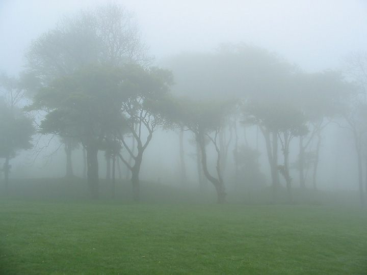
We awoke at 6:00 am to a real heavy mist and decided to have an extra hour of sleep and se if the mist clear. By 7:15 the mist was still quite thick, so we had breakfast and started to pack things away.
The first part of the walk was along a couple of main roads to get up on the Downs. Once on the Downs we had hoped that the mist would of cleared and we would have some views downs into the valleys but everything was shrouded in mist.
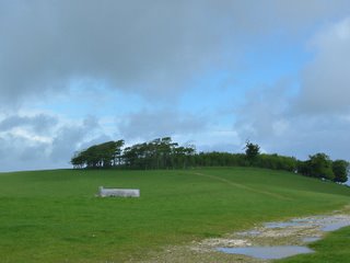
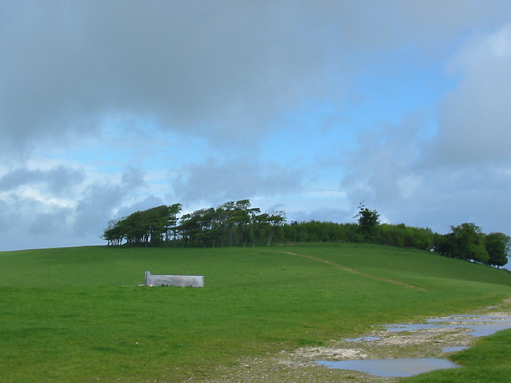
Our first point of reference was the trig point of Chanctonbury Hill but we missed it completely, which isn’t a real problem on the Downs as the paths are very easy to follow. The next point was Chanctonbury Ring, which is an ancient iron age fort but its main claim to fame these days are the beech trees. The Ring can normally be seen for miles around but not today as visibility was only about 20 yards. One minutes there was nothing and the next the trees of the Ring appeared.
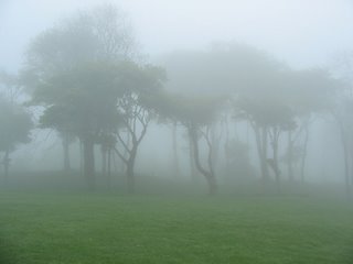
The South Downs way is easy to follow even in mist but I did make a mistake in the map reading (talking to much) and followed a trail down into Bramber, which was about ½ mile North of where we should have been. This wasn’t too much of a problem as it got us out of the mist and we had a nice walk along the River Adur to pick the South Downs way up again.
After crossing the A283 we climbed up Beeding Hill, by the time we reached the up the mist had disappeared and we we had views back to where we had started from.
As the weather seemed to be clearing we decided to stop at the top for lunch and a brew.
One of the problems walking the Downs, this that most campsites are in the valleys; either North or South of the path, which means dropping into the valleys. Our campsite for tonight was to the North but first we had to continue up Truleigh Hill before descending to the village of Small Dole.
Small Dole is a pretty typical English village, a couple of Pubs, one local shop, and smattering of houses. The site we stayed on was part campsite, part farm.
Day Two
Distance 10.9 miles
Height Ascended:1,716 ft
After a good nights sleep; it was another early start. We were awake about 6:00 am and pottered about until 7:30 am and then set off.
As usual we had the gain the height that we lost yesterday, so it was a mile or so walk back to the bottom of the Downs at Edburton village and then a climb up to Edburton Hill. Once up; the Downs roll along with only the minimum of ups & down until reaching Devil’s Dyke.
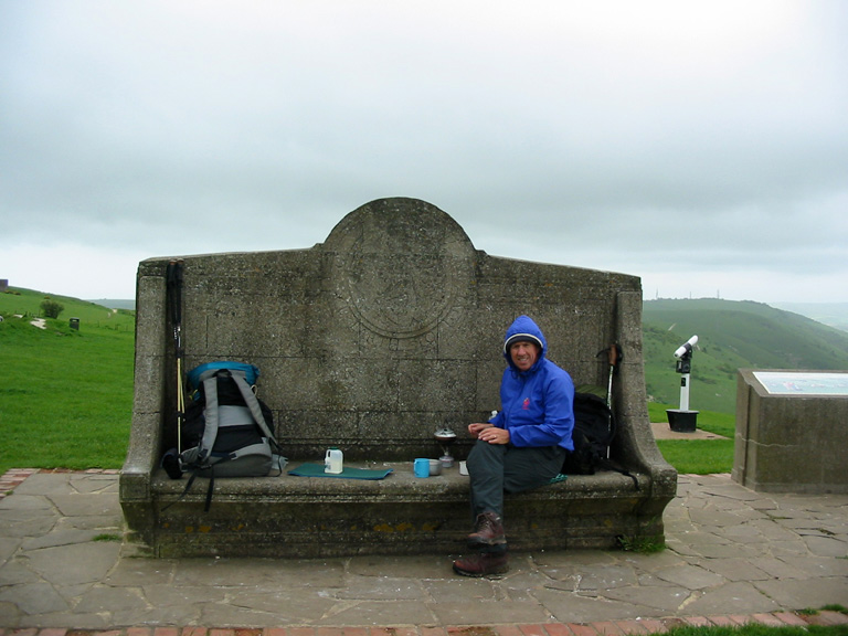
The wind had been picking up all morning and on reaching the Devil’s Dyke it was blowing quite strong, we managed to get on to the leeward side on one of the big concrete seats at the viewpoint and settled in and had a brew. At this point I was so cold I had to put on a fleece and gloves.
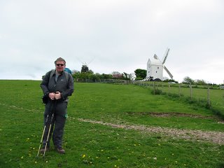
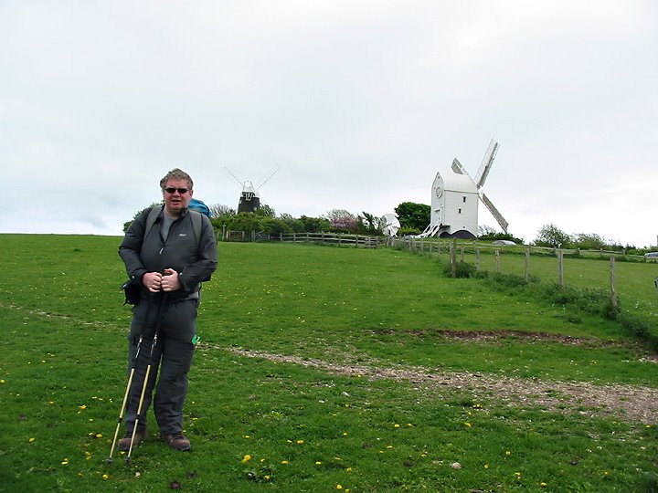
From the Devil’s Dyke the path continues East and there are a few descends down to the road and then back up again, one of the biggest is the descend to the A23 and then the climb back up to the Clayton windmills, which are named Jack & Jill. From the windmills it was another descent North and a further 2 miles to the campsite at Keymer.
A lot of campsites in the U.K. are on farms and this one was no exception, this one was also a large horse riding school with stables and large open paddocks. The campsite was in one of these paddocks.
During the night we had a big storm and the tents took a bit of a battering, at times my tent pole was bending at 50 degrees from the upright.
Day Three
Distance: 12.4 miles
Height Ascended: 535 ft
After a sleepless night and the wind howling across the site, we saw 2 or 3 tents that didn’t survive the night and have broken poles and ripped flysheets.
As the weather was so bad, we needed to change our plans, so we packed up and headed to a nearby café (we’d noticed the day before) and decided what would be the best route to take. Over a coffee and egg & bacon bap, we thought that the high route would be to windy, so we opted for a low level one instead.
The only problem with this, meant a 2 mile walk along the road to pick up a path to take us back Westwards.
We finally picked up a path at Hurstpierpoint and followed the paths across farmland and flood plains. We also passed under the A23 again only this time further North.
On this low level, we had good views back up onto the Downs, which are times were covered in low lying clouds.
Crossing one of the flood plains we came across about 20 bullocks blocking the path, and these animals then decided it would be fun to follow us across the field. This was a bit worrying as they were quite frisky and were barging into each other, we made it to the other side of the field with no mishaps though.
From there it was a mile along the road into Steyning and our last campsite. This site was outside the of the village and about ½ way up the hill which led back onto the Downs; and it was nice and sheltered.
That evening we walked back into Steyning to have a meal and a few beers in one of the pubs. On the way back the heavens opened and it was the first time on the whole trip we had to don waterproofs.
Day Four
Distance: 4.9 miles
Height Ascended: 896 ft
After a reasonable nights sleep; we woke to blue skies, unfortunately this wasn’t to last and by the time we left camp at 8:00 am the grey clouds had rolled is again.
As we were already ½ way up on the Downs, we decided to take the high route, even though it was still windy; although not as bad a yesterday. So we climbed the rest of the way up Steyning Round Hill and rejoined the South Downs, this part was part of the Downs we had walked on the first day. This led us back to Chanctonbury Ring, which we got to see with no mist surrounding it. From the Ring we dropped of the Downs for the last time, mainly to the biting wind. The route then was mainly through farmland for a couple of miles until we were back at the car in Washington.
We were pretty lucky with the weather, it either rained at night or as most times after we had pitched the tents. The only real bad night was the Wednesday and this was probably one of the worse nights I have spent camping on the South Downs.
We only needed to wear waterproofs once and this was on the Friday night coming back from the pub.
16th-20th May 2006
Hikers: George & Peter
We arrived at the Washington Towers campsite on the Tuesday afternoon and just managed to get the tents pitched before it started to rain. This was to be a similar situation for the next few days.
Day One
Distance:12.8 miles
Height Ascended:1,519 ft
We awoke at 6:00 am to a real heavy mist and decided to have an extra hour of sleep and se if the mist clear. By 7:15 the mist was still quite thick, so we had breakfast and started to pack things away.
The first part of the walk was along a couple of main roads to get up on the Downs. Once on the Downs we had hoped that the mist would of cleared and we would have some views downs into the valleys but everything was shrouded in mist.
Our first point of reference was the trig point of Chanctonbury Hill but we missed it completely, which isn’t a real problem on the Downs as the paths are very easy to follow. The next point was Chanctonbury Ring, which is an ancient iron age fort but its main claim to fame these days are the beech trees. The Ring can normally be seen for miles around but not today as visibility was only about 20 yards. One minutes there was nothing and the next the trees of the Ring appeared.
The South Downs way is easy to follow even in mist but I did make a mistake in the map reading (talking to much) and followed a trail down into Bramber, which was about ½ mile North of where we should have been. This wasn’t too much of a problem as it got us out of the mist and we had a nice walk along the River Adur to pick the South Downs way up again.
After crossing the A283 we climbed up Beeding Hill, by the time we reached the up the mist had disappeared and we we had views back to where we had started from.
As the weather seemed to be clearing we decided to stop at the top for lunch and a brew.
One of the problems walking the Downs, this that most campsites are in the valleys; either North or South of the path, which means dropping into the valleys. Our campsite for tonight was to the North but first we had to continue up Truleigh Hill before descending to the village of Small Dole.
Small Dole is a pretty typical English village, a couple of Pubs, one local shop, and smattering of houses. The site we stayed on was part campsite, part farm.
Day Two
Distance 10.9 miles
Height Ascended:1,716 ft
After a good nights sleep; it was another early start. We were awake about 6:00 am and pottered about until 7:30 am and then set off.
As usual we had the gain the height that we lost yesterday, so it was a mile or so walk back to the bottom of the Downs at Edburton village and then a climb up to Edburton Hill. Once up; the Downs roll along with only the minimum of ups & down until reaching Devil’s Dyke.

The wind had been picking up all morning and on reaching the Devil’s Dyke it was blowing quite strong, we managed to get on to the leeward side on one of the big concrete seats at the viewpoint and settled in and had a brew. At this point I was so cold I had to put on a fleece and gloves.
From the Devil’s Dyke the path continues East and there are a few descends down to the road and then back up again, one of the biggest is the descend to the A23 and then the climb back up to the Clayton windmills, which are named Jack & Jill. From the windmills it was another descent North and a further 2 miles to the campsite at Keymer.
A lot of campsites in the U.K. are on farms and this one was no exception, this one was also a large horse riding school with stables and large open paddocks. The campsite was in one of these paddocks.
During the night we had a big storm and the tents took a bit of a battering, at times my tent pole was bending at 50 degrees from the upright.
Day Three
Distance: 12.4 miles
Height Ascended: 535 ft
After a sleepless night and the wind howling across the site, we saw 2 or 3 tents that didn’t survive the night and have broken poles and ripped flysheets.
As the weather was so bad, we needed to change our plans, so we packed up and headed to a nearby café (we’d noticed the day before) and decided what would be the best route to take. Over a coffee and egg & bacon bap, we thought that the high route would be to windy, so we opted for a low level one instead.
The only problem with this, meant a 2 mile walk along the road to pick up a path to take us back Westwards.
We finally picked up a path at Hurstpierpoint and followed the paths across farmland and flood plains. We also passed under the A23 again only this time further North.
On this low level, we had good views back up onto the Downs, which are times were covered in low lying clouds.
Crossing one of the flood plains we came across about 20 bullocks blocking the path, and these animals then decided it would be fun to follow us across the field. This was a bit worrying as they were quite frisky and were barging into each other, we made it to the other side of the field with no mishaps though.
From there it was a mile along the road into Steyning and our last campsite. This site was outside the of the village and about ½ way up the hill which led back onto the Downs; and it was nice and sheltered.
That evening we walked back into Steyning to have a meal and a few beers in one of the pubs. On the way back the heavens opened and it was the first time on the whole trip we had to don waterproofs.
Day Four
Distance: 4.9 miles
Height Ascended: 896 ft
After a reasonable nights sleep; we woke to blue skies, unfortunately this wasn’t to last and by the time we left camp at 8:00 am the grey clouds had rolled is again.
As we were already ½ way up on the Downs, we decided to take the high route, even though it was still windy; although not as bad a yesterday. So we climbed the rest of the way up Steyning Round Hill and rejoined the South Downs, this part was part of the Downs we had walked on the first day. This led us back to Chanctonbury Ring, which we got to see with no mist surrounding it. From the Ring we dropped of the Downs for the last time, mainly to the biting wind. The route then was mainly through farmland for a couple of miles until we were back at the car in Washington.
We were pretty lucky with the weather, it either rained at night or as most times after we had pitched the tents. The only real bad night was the Wednesday and this was probably one of the worse nights I have spent camping on the South Downs.
We only needed to wear waterproofs once and this was on the Friday night coming back from the pub.
Saturday, 6 May 2006
Gadgets on the trail
The two main gadgets I take when walking are my camera and mp3 player.
The camera is a Canon A40 which although a bit heavier than the newer point and shot cameras; is a great little camera. It takes 4 AA batteries which seem to last for ages.
The only problem with these cameras are that they don't take a filter straight to the lens, which means that I have to have an adaptor on the camera and this then makes it a bit bulky.
All the pictures on the blog and photo gallery are taken with the A40.
I like to be able to listen to music when I`m in camp and for this I use an Iriver iFP790. This player is only 256mb but does have a FM radio built-in and I can normally get 6 hours or so of music on it. The Player takes 1 AA and the bettery life is pretty good too.
Sunday, 30 April 2006

London Loop
The London Loop is a circular walk (in 24 sections) in and around the suburbs of London.
The offical start is at Erith in South London.
The first section is 8.3 miles (13 km) long and goes from Erith to Old Bexley via Erith riverside; Queen Elizabeth 2 Bridge; Darent raised dam; Crayford Marshes; Crayford; Churchfield Wood; Hall Place, Old Bexley village.
The start is along the River Thames and through the industrial heart of Erith, as this is an urban walk some parts are quite depressing.
On one side of the path is the Thames on the other is wrecker's yards.
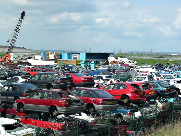
It's amazing that there can be wonderful scenic views directly oppostion.
More pictures from the 1st section of the London Loop can be seen at http://www.pbase.com/georgegriffin/erith_to_old_bexley
Subscribe to:
Posts (Atom)