Showing posts with label Trip Report. Show all posts

Saturday, 27 March 2010

6 30 16

Yesterday was spent in the company of Mick & Gayle; who have recently set out on their next long distance walk.

As they were passing close to home; I thought it would be good to join them for a day's walking.

Ou meeting place was Dartford; and after making our way out of there along a busy A206, we finally linked up with the River Darent, and then on to the River Thames.

Most of the area around the Thames here is very industrial, from modern sewage works (a bit pongy) to a 18th century pump house.

Crossness Pump House


Mick & Gayle along the Thames

As the route moved closer to Central London the industrial side started to give way to the luxurious apartments along the Thames and especially Around the old Royal Woolwich Arsenal.

Cybermen???*

Up until now the weather had been pretty good with sunshine and the odd dark cloud passing over but no rain. We stop in the Firepower cafe for lunch; and this was time for the rain to come.

By the time lunch was finished; so was the rain and we set out again to sunny skies, and only four miles to Greenwich.


At this point the London skyline starts to show off some of its interesting architecture; like the Thames Barrier, Canary Wharf and the O2 Dome.

From the Barrier we took a bit of a short cut to avoid going around the dome; this ment crossing the A102 but luckily there was a footbridge crossing it. At this point we rejoined the Thames path but it seems as someone had closed this section; without informing any one. So there was a bit of backtracking to take to the roads to finally get in to Greenwich.

From here Mick & Gayle went off to catch a train to their campsite for the evening and I walked down to the Cutty Sark to get the DLR home.

* thanks to WD for that

Monday, 28 September 2009

Elan Valley 3

The final day started off with a bit of a start for me; when I opened the inner of my tent, I found that the outer had been invaded with lots of spiders. Glad I wasn't in a tarp and bivvy.

After a quick brew and breakfast; I dealt with the spiders and then packed up. Today was going to be hard on the feet mainly because most of the walking would be on track and cycle paths.

We still had nearly 2 miles of the reservoir track to walk before hitting the road, that makes almost 6 miles off reservoir track.


Dam of the end of Claerwen reservoir


The road and cycle track were hard on the feet; and with hindsight and looking at the maps when back home there were a couple of alternatives we could of taken.


Bridge across Caban-coch reservoir


Overall this was a pretty good walk; the weather stayed good for the whole trip and we managed to find a quicker route home, living in the SE of the Country doesn't lend it self well for trip to Wales.

I have some thoughts on equipment and food from this trip but I'll leave them for another post.

In the mean time here is some video from the trip.

Elan Valley 2

I awoke about 6.00am on Friday and the hillside was covered in mist, so decided to have an extra hour in bad. By 7.00 am the mist had lifted but it was looking like it was going to be a cloudy grey day.

We broke camp around 9.00am and headed West to pick up the Monks trod again at Pont ar Elan, this is part of the Elan Estate and also the area covered by the many reservoirs serving Birmingham and the Midlands.

Criag Goch Reservoir


The path climbs in a Westerly direction from the reservoir and eventually plateaus out, it was quite boggy in parts and the path seemed to run off in different directions, there were the occasionally signposts but at time these were 10 to 20 yards away from the path we would be on.

Although it wasn't hot; it was hard and thirsty work, and this did cause a problem. Although boggy there wasn't a good supply of water up on the top. At the Llyn Cerrigllwydion lakes, it looked possible to get down to them from the path but once closer, it was a steep climb down and the way back out didn't look to inviting.

We pushed on and finally found water, in a small crack in the ground with water running off the hillside.

We continued on down to the Afron Claerwen; where we across the river and stopped to have lunch, at this point I realised I'd lost my mapcase, I'm not sure if it was as I was manly striding down the hill or more likely when I bent down in the river to collect water, either way it was pretty stupid and dangerous not to keep my mapcase somewhere safer. Lucky we both had maps; so had to continued on Keith's.

We now had a decision to make; do we continued West and make for the Llyn Teifi lakes or stay on the original route. The route across to Llyn Teifi on the map looked O.K.but on the ground it looked very sketchy and boggy, so we went with the original plan.

We re-crossed the river and picked up a sheep track going up and around the back of Claerwen Farm; this brought us out on to the reservoir track, which we had the joy of walking on for the next 4 miles.

Start of the Claerwen reservoir and track


So far on this trip we haven't see any walkers, we did meet a couple driving at Pont ar Elan but that was all, until the track we finally met a group of D.o.E.

We had a rough idea on where to pitch or the night; we found an alternative site but did have to carry 3 litres of water up to it.

Two things on this trip I've never seen so much of is sheep and sheep s**t!

Elan Valley 1

This trip didn't get off to the best of starts with a 2 hour journey to get from SE London to West London and then 5 hours to get into Wales.

We hadn't check to road route in and the route we took was the most straightforward but unfortunately it was also the longest.

We finally arrived in Rhayader at about 4.30pm; which turned our gentle afternoon stroll into a bit of a race to get to the area we were looking to pitch at that night.

Leaving Rhayader we headed NW to pick up the Ancient track that goes across Penrhiw-wen; this track forms part of the Monks Trod which runs from Strata Florida Abbey to Abbey Cwm-hir about half way up the slopes of Penrhiw-wen we headed North to cut across the Nant y sarn river.

We were hoping to camp near to the river but the slopes on either side were fairly steep and very boggy. After getting water we had a scout about and it seems the best place to pitch was next to the ruin.


Thursday, 28 May 2009

Tidy up

Most of the gear is now out on the line; drying in the warmish sunshine we are having in London.

In hindsight; I don't think I realised how bad the conditions were, although raining it wasn't that bad but the wind was constantly driving it in to us and although I'm not usual good walking in the rain was happy to keep walking.

It wasn't until we got into the open along the coast at Old Harry rocks that the wind was really felt, and walking into the head wind was a challenge, so I understand why Bex had, had enough.

From this..


To this


I suppose this is one of the problems of having the arrange thing so far in advance and only having School holidays to do them in.

I also had a bit of a shock; it must be over 10 years since I shared a tent with anyone, and this really threw me. Whenever I've used the Nallo in the past, I've found plenty of room to store gear, move around and forgot how different it is with two and especially a 11 year old who at times can seem to have St Vitus dance.

Part of this problem was that she was bored once we were camped. I tried to make this as late as possible (around 5 o'clock) but this didn't help.

The walking wasn't a problem at all; as she walked about 4 miles on the first afternoon and in the few hours the next day cover nearly 6.5 miles and there wasn't any complains about carrying the rucsac.

I not sure what the next move will be, but I'll wait and see if she asks again about going backpacking with me.

As for me; I want to try out a night bivvying somewhere but it will definitely need to have good weather for that.

Monday, 25 May 2009

All packed

I'm all packed and really to go, pack weighs in at 11kg which isn't bad considering I`m carrying 2x2 days food and a 2 person tent.

The tent is the Hilleberg Nallo2; which actual weighs the same as my TN solar, I do have the older style one, not the one with the sloping back,which I find better.

Bex's pack weighs in at 6 kg which feels lighter than her bag for school each day, so hopefully there won't be any problems carrying it.

I'm going to joining the throng of people trying out mobile blogging on this trip, I know there are a few big transmitters in and around Swanage so getting a signal shouldn't be a problem.

Sunday, 1 June 2008

Video of the Cairngorms

The video from the Cairngorms are now live on Youtube.

Normally I would post the video's into the blog but as Youtube compresses them a fair bit they can look blocky.

If you go to the links below it with take you to the video's and if you click on the "Watch in high quality" you get a better picture.


Link to Cairngorms 2008

Link to Cairngorms 2008 Pt 2

Rothiemurchus Forest - Aviemore

Monday 25th May

Our final day in Scotland.

We only had about 6 miles to cover today but we were still up early and away by 9:00.

Most of the final day's walk was through the forest on easy tracks, so we made good progress.

rothiemurchus

Through the forest

Once across the Cairngorm footbridge; the paths started to open up and we had views to the mountains Southwest of Aviemore.

We walked up the Loch an Eilein and saw a little white house with people milling around it. Ah! a tea shop! but before the tea shop a quick walk around the loch to get a better look at the castle in the loch.

castle Castle on the Loch

After taking some pictures we made our way back to the tea shop. Disaster; the tea shop, is not a tea shop! but a RSPB visitor centre. They did have a tea/coffee machine in there but I set myself up for a bacon butty, so I ended up with a bag of crisps and a Fanta.

The route out was via the Car Park and there were a fair few cars parked up, it was strange starting to see big groups of people after the last few days of not seeing any.

We knew we were getting back to civilization, when we could hear cars and sirens coming from Avimore way.

Finally in Aviemore; we made our way up the high street to the mountain cafe, where we had a big all-day breakfast with unlimited tea/coffee.

After this we had a wander in and out of the tourist shops, we still had an eight hour wait for the night train back home.

We did find a little garden in the centre of Aviemore and chilled out there for most of the afternoon.

At one point we think we saw Chris Townsend walking up the high street to the local supermarket.

At 20:30 we made our way to the railway station to wait for the train. We got chatting to the station master, who informed us that he was retiring on the 30th May.

So happy retirement; Willie.

The last thing we saw and hear before boarding the train was a piper, which was a nice send off.

piper

Piper at the Gates of Dawn?

That's the end. I did get to see Red Squirrel & the Red Deer but no Highland Coo's and no stag antlers.

A big thanks to Robin who original walked this route and I just picked his brain and copied the route.

I'm already looking at maps and see where & when the next trip to Scotland will be, and as for this; I think I'll forget about it for a while.

Corrour Bothy - Rothiemurchus Forest via Liarig Ghru

Sunday 25th May

Another day; another hole. It seems as my sleeping mat has developed a hole, although it must be a very small one as it takes about 6-7 hours for the mat to deflate even with me on it. 

Today's route is over to Rothiemurchus Forest via the Liarig Ghru. The Liarig Ghru is one of the best known mountain passes not only in Scotland but in the U.K. I had heard a lot about it but still didn't know what to expect once up there.

We said our goodbyes to Duncan, and set off back down to the bridge crossing the River Dee, as the main path runs up the Eastern side of the Dee.

Again the paths were good to start with and we made steady progress.  One of the first thing we were looking of today was the Clach nan Taillear. We think that the picture below is it; as it is on the right side of the path and close to where the path to Carn a`Mhaim goes up from the Liarig Ghru (this was to be Duncan's route for today).

clach non taillear

Clach nan Tailler

From Clach nan Tailear the path climbed continuously and started to get a bit rougher, as we climbed the views across to Cairn Toul & up to Ben Macdui opened out.  Yesterday we had spend the latter part of the day looking at the Devil's Point and to never seems to get closer; today we couldn't get far away from it.

liarig ghru

Looking North

Devils point

Back to the Devil's Point

One of Duncan's parting words were "watch out for the boulders" and just before the Pools of Dee; we hit them.  These boulders are BIG, you have to be really careful where you place your feet as it could be so easy to misplace a step and break an ankle. A couple of times I got a pole struck in the gaps and it needed a good pull to retrieve it.

boulders

Boulders everywhere

We finally made it to the Pools of Dee and stopped there for lunch. while sitting there people started to arrived from the other direction (Aviemore) and pass by. 

There was still some snow lying in the pass, and at some places it looked to be 6-8 inches deep. Shortly after the Pools of Dee; we hit a marked cairn, this turned out to be the height cairn of the Liarig Ghru, we were at the highest point 835 m (2733 ft).  So everything from here was downhill.

Although all downhill; it wasn't easy, again the path seemed to disappear and then reappear somewhere else. It wasn't until we arrived near the start of Allt Druidh that the paths were more defined. 

Allt Druidh

Allt Druidh

All the climbing over boulders and non-defined paths made for a bad day for the feet, by the time we reached the Rothiemurchus Forest my feet felt a bit bruised and battered, it was nice to be on smooth paths again.

start/finish

Start/finish of the Liarig Ghru

We made our way to the clearing in the Forest and set up our final night's wild camp.

camp

Camp in Rothiemurchus Forest

Saturday, 31 May 2008

Glen Tilt - Corrour Bothy

Saturday 24th May

Today was the start of a couple of big days; not in distance or high gained but in what we would hopeful get to see.

After yesterday's early start, we had a lie-in and didn't get started until 9:50. While packed up I noticed a small hole in the groundsheet of the tent, there didn't seem to be anything under the tent to cause this, so I don't know how it got there.

Again; the paths were the same as yesterday, easy to follow and easy of the feet.

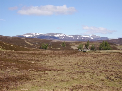
As we started to climb, the views started to open out the show the higher peaks still with snow on them.
snow

Snow covered peaks

On the way to Bynack Lodge; we realised that we had crossed the watershed as the Allt an t-Seilich was flowing Northwards, where yesterday the streams had flowed South.

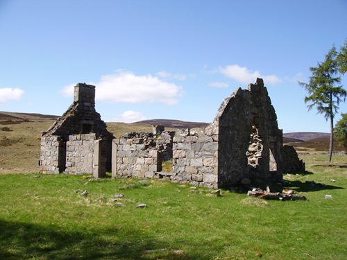
As the weather was so good and there was no need to rush, we stopped at Bynack Lodge for elevenses.
bynack lodge

Bynack Lodge

Now came the first test of our river crossing skills as the path we wanted was on the other side of a fairly wide stream. Keith seemed to bound across like a gazelle, leaving me to wondered where was the best place to cross. Eventually I made it across without any drama's and dry feet.

The path along here was pretty non-existence and we just headed in a Northerly direction occasionally following deer tracks, eventually we joined up with a Land rover track which lead us to the Geldie burn.

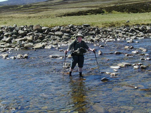
The Geldie burn crossing was the biggest river crossing we would encounter, it was also the thing I was worried about most. I'm not very confident when crossing rivers, even stepping stones can be a problem for me.

We did had a scout down the burn to see if there was a better place to cross but ended up back at the main crossing point. As I had been warned about this crossing I had come prepared. So it was off with the boots and on with crocs and sealskinz socks.

As usual Keith seemed to cross in a flash, and as usual I was more tentative. I was about 1/4 of the way across when a young lady came bounding through the burn only stopping to have a quick chat (she was in training for the Braemar to Aviemore marathon).

The rocks under the water had a green slime on them which made them quite slippery the water also seemed deeper than the height of the sealskinz and I expected the water to go over the tops.
Gldie Burn

Crossing the Geldie Burn

I finally made it across without to much trouble; the sealskinz worked a treat no wet feet.

One thing I did find out though; putting your boots around your neck isn't a great idea, as they tend to block the view downwards to where your feet are going.

From here it was only a short distance to White Bridge, along the way we saw a young deer pop out onto the track about 20 metres in front of us. To begin with it didn't know we were there but once it sensed us it was off like a rocket.

We got to White Bridge just on 13:00, so stopped for lunch. This seemed to be quite a busy junction, as there were many people passing by. We were due to meet up with AktoMan (Duncan) at some point during the day. So while eating lunch I kept an eye out incase he passed by.
DIGITAL CAMERA

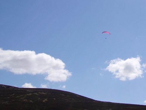
Paraglider

We stayed at White Bridge until 14:00 then decided to start up Glen Dee, as we weren't to sure how long it would take to get to the bothy, plus we were hearing tales that there could be a lot of people camping up there.

We set off up Glen Dee and noticed a hiker coming towards us, just as he drew level I remembered that AktoMan had said that Big Galloot was walking in the area. "Are you Big Galloot, Big Kev?" I asked. "Yes" was the reply, we had a quick chat about the weather, scenery and general outdoorsy stuff. I asked Big Kev that if he bumped into Duncan, to let him know we were continuing up the Glen. We then set off again on our routes.

The track up Glen Dee starts out as an easy walk up to the Chest Of Dee, this early part follows along side the river.
chest of dee

Gradually the path start to move away for the river and climb up. We saw very few people on this part of the walk and although we could see the Devil's Point it never seem to get any closer. after climbing to around 550m we did finally meet someone coming the other way but still no sight of the bothy. They stopped to have a chat and said that the bothy was about a further hour walking. Although the walking hadn't been to bad, we had been walking for quite some time and it was demoralising to know we still had an hours walking ahead.

bothy

Corrour Bothy

We finally arrived at Corrour Bothy about 17:00. There were quite a few people milling around but no tents pitched yet, so while I chatted Keith looked around for a decent pitch. There was a couple of chaps already settled in the bothy and the rest of the people were only resting up after a day up on the tops.

While we were pitching up a few more people were coming of the mountains, there was an American couple who pitched up and other two chaps came down and pitched.

Shortly after this Duncan turned up. Once he was pitched we stood around chatting and watching the deer bounding pass.

Duncan had also bought along some treats, some sake and some of Darren's overflow food from his recent TGOC. Thanks to Duncan and Darren for these.

By now the sun had dropped below the mountains and it was getting chilly plus Duncan haven't eaten, so I disappeared into the tent to get some shut eye.

Friday, 30 May 2008

Blair Atholl - Glen Tilt

Friday 23rd May

Although we were on a sleeper; we didn't have a berth but instead were in the airline type seats.  These seats were reasonably comfortable and Keith got his head down down fairly early, I was quite happy to watch the stations flashing by.

At Preston; I decided to try and get some sleep as it was about 23:45. From the time of leaving Euston, we were facing towards the direction of travel.  When I awoke at Edinburgh we were travelling backwards, when you've just woken up this can be very disconcerting.

I dozed off again and woke at Perth, which meant we were getting closer to our destination.

The train finally arrived at out starting point; Blair Atholl at 6:30 and after sorting out out packs we were off and walking by 7:00.

As we had everything we needed for the trip we didn't go into the centre of the village but made our way straight out to Glen Tilt.

Some of things I was hoping to see on this trip were; Red squirrels, Red deer, Highland coo's and maybe find some stag antlers.

The early part of the walk through Glen Tilt is in woods, and this gave us a chance to see some red squirrels; although they are a lot more nervous than they grey cousins and don't hang about to long.

Glen Tilt slowly climb up and way from Blair Atholl and eventually opens out from woods to open fellside.  This part of the walk felt like walking in the Howgills.

Glen Tilt    

Glen Tilt

About 11:00 we stopped for breakfast, we found a nice spot down by the river just South of Clachghlas.

Most of the tracks were either Land rover tracks or good defined paths, so the walking was pretty easy.

Although it was overcast we had good views up & down the Glen and also on to the tops of Carn Torcaidh, Meall Gharren and Dun Beag.

By about 15:00 we arrived at the Falls of Tarf, this was one of the places I had earmarked as a possible wild camp but the areawasn't as flat as we hoped.  We decided to have luch there and then move further up the Glen to find a pitch.

DIGITAL CAMERA

Falls of Tarf

As we left the Falls of Tarf, we started to climb again and also left the River Tilt behind, we then picked up the Allt Garbh Buidhe.

We finally camped about halfway along the Allt Garbh Buidhe after covering about 14 miles.

Thursday, 29 May 2008

Don't Panic!!

Thursday 22th May

As usual for me, stress levels were running high in the lead up to this trip and this meant a last minute repack of some equipment before setting off.

I arrived at Euston at 19:40 to catch the 21:15 night train, at is point there was no sign of Keith but that was O.K. as we had plenty of time.

Euston like most urban railway station's nowadays doesn't have to many places to sit, on the concourse; so it was either in the restaurants or the bars. As it was quite warm I decided to sit outside with the smokers *cough*.

About every 10 minutes or so; I would pop back into the station to look for Keith. By 20:15 I was starting to get worried because there was still no sign of him, a call to his mobile came back with the dreaded "the phone you are calling is switched off".

After some frantic calls to SWMBO to get Keith's home number. I phoned his house to be told that he didn't have his mobile with him and that he had left at 17:30 or so.

By now I was getting really stressed out, as it was about 20:40 and the train was already boarding. Another call to SWMBO to help calm my nerves, when all of a sudden I saw Keith walking across the concourse.

PHEW!!!

He had decided that instead of using the underground, he would walk from Victoria station to Euston but didn't reckon with all the crowds.

After this little panic the train journey was easy and relaxing.

Wednesday, 28 May 2008

Cairngorms 2008

All the pictures from the walk are now up and ready to view on Flickr
or can be viewed on the viewer below.


I'm still working on the trip report and the video.

Tuesday, 27 May 2008

Back Home

I'm back home with hopefully plenty of pictures and video from the Cairngorms trip in the meantime here's one from the collection.

Tuesday, 29 April 2008

Peak District Weekend Part Two

We had decided that we wouldn't camp at the campsite where the backpackers club were, for two reasons firstly because we wanted to get away early the next morning and secondly there didn't seem to be a great deal of room.

Leaving Ashford-in-the-water; we headed South-west towards the village of Sheldon, this involved a steep-ish climb out of Ashford and got the leg muscles working after sitting around for a couple of hours.

The climb up finally flattens out after a mile and opens up views across to Magpie Mine.

Usual on maps with mine (dis); you normally only expect to see some lumps and bumps on the ground but here there is a great example of a 19th century lead mine.

PICT0640

Magpie Mine

There is plenty to see in and around the site from the Cornish Engine house to the mine's cottage.  I could of spent a couple of hours walking around the site and taken photographs.

PICT0644

Winding Gear

From there we continued South-west and came across this big fellow.

PICT0652

Luckily the footpath to Monyash didn't go through this field.  Once back in Monyash we headed straight to the Smithy cafe. From there we went back to where we left the car and meet up with the owner of the campsite.

He informed us that there was a group of about 20 D.O.E's down on the site.  Keith decided that he couldn't take another night of, no or little sleep; so we set of home.

Monday, 28 April 2008

Lightweight Show

The first port of call was the camping site where the Backpacker club were camped.  It seems as the camping area was split in two; one side for the campers and one for all the lovely shiny new tents.

Although I'm not in the market for a new tent (yet!) it was nice to see the big range of lightweight tents out there.

While at the campsite I bump into a couple of old BPC friends and a reader of the blog (trenthamwalker).

The main and most interesting part of the show was a 10 minutes walk away at the Village hall; where most of the well-known lightweight traders were.

Backpackinglight.co.uk, Alpkit, Expedition Foods, Ultralight Outdoor Gear and The Outdoor Warehouse.

The one great thing about this show was that you could get all touchy feely with a lot of the gear we see on the Internet. Although I'm not really happy using an alcohol  stove, it was nice to see the Caldera cone in the flesh.  Also seen was the White box stove and Triad stove; with which Bob did a demo with.

As I wasn't staying at the site; I couldn't buy to much as I had to carry it.  I picked up a tick remover and some freeze dried food from Expedition foods.  I'm looking at maybe taking these to Scotland instead of dehydrating my own food.

One of the items that did turn my head was the new GoLite  Shangri-La 2 tent/tarp this look a nice piece of kit and at a weight of only 708g but with as much room as my Hilly Nallo2. Even with the floor added the weight is still only 1200g.

While at the show I managed to link up with John, Dawn and Darren. After a lot of faffing about trying to get some lunch in the two pubs we descended on the local village shop who were happy to serve us, then back to the village hall to sit on the grass and shoot the breeze about gear and forth coming trips.

As usual I spent more time chatting and looking at equipment, that I forget to take any pictures of the show.

Again it was good to see some old friends there and the few people who recognised me from the blog.

Peak District Weekend Part one

This weekend was arranged to fit in with the lightweight show that was being put on in Ashford-in-the-water and not wanting to spend the whole weekend on one site, it was decided to do a full backpack and take in the show on the Saturday.

It was also a chance to test out some of the equipment I maybe taking to Scotland in May.

Monyash was decided as the best place to start out from to have a good walk on the Friday, to then give us a short walk in to the show on the Saturday.

The Friday didn't start to well, when my pocket rocket didn't want to connect with the Coleman's  Gas canister I had brought for the weekend. After some heavy handed tightening I finally got the stove to work.

This problem has happened on a couple of occasions and I think one of these days , I'm going to strip the thread off the stove.  Maybe it's time for a new one.

Our intended route was to go north from Monyash, through Deepdale and Monsal Dale then get up onto the edges above Great Longstone, then onto the Eastern edges above Curbar and Baslow.

We followed the route until just West of Baslow; where my legs decided that they didn't fancy a climb up onto the edges, so we dropped down in to Baslow and made our way to the little shop/cafe just outside Chatsworth Park.

By now it had started raining so it was on with the waterproofs.  We took the lower path through Chatsworth to the Robin Hood Pub and then up to the Eric Byne Campsite.

In total we covered just under 13 miles; which wasn't bad for a first day's walk for many months.

The site was empty where we arrived but this was to change over the next few hours.

Anyone who knows the Eric Byne, will know that it is a massive field, room for probably 200+ tents.  So why this it that when a group of D.O.E's arrive; they have to camp right next to us.  Not only this but as the evening wore on more groups arrived and set up around us.

I now know how Custer felt.

They were a very noisy bunch; I had my MP3 player going most of the evening and then earplugs during the night, so missed most of the problems.

Next morning; Keith told me, that the noise was so bad that he had left his tent and bivvyed in the next field to get away from them.

There were about 50-60 D.O.E's all around us, so we had a quick breakfast and set off for the lightweight show.

The route was back into Chatsworth but this time taking the higher level over Dobb Edge then down to the main house.

Going through the park we saw some deer and I had a 'johnny Kingdom' moment trying to creep up on them to get a better picture. I was using a big boulder to screen myself but by the time I got there they had run away (I need to work on that!).

After this we walked through Edensor village to Bakewell and a slight detour to get an original Bakewell pudding for SWMBO and then on to the lightweight show.


View Larger Map

Saturday, 26 May 2007

Random thoughts

Being back a few days has given me a change to look through the equipment I took and assess how well it worked and how useful it was.

PACK

As usual the sixmoondesigns Comet pack carried the loads really well; the weight in the pack varied between the starting 11 kg and about 12.5 kg when carrying extra food and water.

I found that there was plenty of room; even with a wet flysheet for the first few days. The three outer pockets carried everthing I needed to hand during the day.

I did have one problem with the pack and that was the left shoulder strap came away from the joining point on the hipbelt. At first I thought the strap had snapped but in actual fact all that had happened was that the stitching had unravelled and the strap had popped out.

I was able to jury-rig it for the rest of the walk, and my wife had manged to re-stitch the strap back in.

SLEEPING BAG/MAT

The sleeping bag is a Field&Trek own make which I bought last year in the sales. It a 2-season down bag and kept me more than warm enough in fact a few nights I slept with it thrown over me like a quilt.

My sleeping Mat is the Insul Mat Max-Thermo; which I`ve been using for about 3 years.

I can't imagine sleeping on anything else now, as this is probably the most comfortable mat I've ever used. Yes; it is a bit heavy at 700g and can be a extra chore blowing it up at the end of the day but it's still worth it.

TENT

Terra Nova Solar 1

The biggest think I like about the Solar is the way the fly can be opened and give plenty of options for getting in and out.

Is tent weighs around 2kg which is a bit heavy compared to today's new lighter weight tents. I do think about changing the tent to a lighter one but as yet I haven't see one that is a flexible as the Solar.

COOKING

As usual the MSR PocketRocket performed great for cooking and brews on route. I took two pots and a plastic mug; the pots were non-stick, I also took a 250 gas canister which was just about enough for the amount of cooking I did.

GADGETS

I took a few gadgets on this trip; some worked better than others. The Freeloader worked O.K but in all honesty I only used it once to charge the mini-vidcam and probably would of gotten away with a couple of extra batteries and saved a few grams.

Th new mp3 player worked well but didn't have as much power as I thought it would and was flat when I could of really used it and that was on the trip home; I should of taken the sync lead and charged it through the freeloader.

The mini-vidcam was a good item to take; I took 2x1 GB sd cards but only used one, I may of used the extra one if the weather had been better in the early part of the trip. I enjoyed videoing along the way and being able to report on things as they were happening.

It a shame that it only takes 640x480 video and the still pictures are not as good as a normal digital camera so that ment I was carrying two digital cameras.


CLOTHES

I took 3 pairs of pants, 2 pairs of socks, a pair of Ron Hill trackers trek, a ploymide shirt, t-shirt, montane windshirt, a Peter Storm micro-fleece, Peter Storm waterproof trousers, a Craghoppers Pakka waterproof jacket and a tilley hat.

I could of done with an extra pair of socks as it was difficult to get the ones I had dry in the first few days because of the rain.

The waterproofs worked far better than I thought they would especially with the amount of rain we had in the early days.

The Montane was a good choice for when to wasn't raining and especailly when out in the open with the winds blowing.

All in all; the equipment I took performed as expected and I only had one piece that I never used and that was the Tikka headtorch.

Best piece of equipment was the Tilley Hat; when it was rain the hat kept my head dry and the brim stopped the rain dripping on me and when the sun came out it helped to stop the sun burning my face and neck.

Thursday, 24 May 2007

I'm Back

Got home late yesterday evening after a disaster getting through London. Victoria Station was closed just after I arrived there; so I had to make my way home by bus.

Had a great week; weather was a bit mixed with rain for the first couple of days and then rain and sunshine for a couple of days then sunshine for the final days into Windermere.

I picked up a couple of blisters on the soles on my feet but nothing to bad; although I am hobbling around today.

A couple of pictures from the walk.


Me at Bolton Abbey


Lowgill Viaduct


I'll put the rest up over the next few days.

Saturday, 7 October 2006

Two go camping in Dorset

3 1/2 days in Dorset


27th-30th September 2006

Hikers: Peter & George

Day One
Distance: 9.1 miles
High Ascended: 1194 ft


The trip was similar to one we did a couple of years ago following the
Purbeck Way. We started in Ridge just outside of Wareham.

We arrived about 5 pm on Wenesday and set-up the tents straight away. We then started on the wine :)

We woke to overcast skies and the forecast of rain, so we had a quick breakfast and packed up.

100 yards down the road and the rains started so it was on with the waterproofs and ready for a day of rain.

Luckily by the time we got to Stoborough Green the rain stopped and the Sun and blue skies re-appeared.

The walking was pretty easy on both the eye and the feet, as the terrain is open heathland.

Me on Creech Heath
Image Hosted by ImageShack.us
Within a couple of hours we were in Corfe Village and made our way straight to the village bakery, in the bakery window was a notice proclaiming '3 bacon rashers in a bap £1.80' both Peter and I thought that would make a nice mid-morning snack.

Unfortunately they only had 3 rashers left but Peter could see I was flagging in a big way and allowed my to have them :) (Thanks Peter).

After our brunch stop, we made our way out of Corfe and up onto East hill.

Corfe Village from East Hill
Image Hosted by ImageShack.us

Image Hosted by ImageShack.us
Corfe Castle

Once we were up on the ridge of Challow Hill,Bollington Hill and Brenscombe Hill we had brilliant view back down to Corfe and over to Studland & Poole.

Image Hosted by ImageShack.us
Studland & Poole


At Brenscombe Hill we decided that it was time for another Brew :)

Image Hosted by ImageShack.us
Peter's tea break

From here we dropped down to Harman's Cross, where I nearly got run over. I was trying to get a picture of the steam train leaving Harman's Cross Station and going under the bridge and as the steam from the engine came up I stepped back into the path of a car, luckily he saw me and stopped.

From here we made out way the short distance to Woodyhyde Farm for our night's camp.


Day Two
Distance: 12.3 miles
High Ascended: 1960 ft


After a very rainy night; we woke to more rain. Today we were aiming for Tom's Field in Langton which as the crow flys is about 1 1/2 miles from Woodyhyde but we were going to do a big circuit.

As the weather was poor and still raining we don't start until 9.30 am. Out route for today was back to Harman's Cross and back onto the ridge, but because of the rain we decided to stay on the lower path of Ailwood Down. After about an hour's walking the rain stopped and the Sun was out, so off came the waterproofs.

We followed the path down to the road near Ulwell and then climb up to the Obelisk on Studalnd Hill and followed the ridge across to Ballard Cliff. All the while the weather was quite good and we had views downs to Studland and Swanage and across to the Isle of Wight. As we desended down Ballard Cliff the weather started to turn again so it was a rush to get into Swanage before the rain came again.

There is a point where the coatal path reaches the beach but the path continues up into the outskirts of Swanage and this is a plod into the town centre. This time we took to the beach and within 10 minutes were in the centre of town.

We made our way to somerfield s for lunch and then found a shelter to sit and eat it in. We also got our stoves out for a brew, which seemed to amuse the passers by.

By now the rain had set in again and the route around Durlston bay and Durlston Head didn't look to appealing. So we looked for an alternative route, we found one which went up through the town and then out to the open countryside.

The only problem with these routes through towns and housing estates, is that you get disorienated and lost :( After tramping around different allyways and small footpaths we finally found ourselves on the main road up to Durlston Head (Grrrr!!!).

We then made our way out to the lighthouse at Anvil point. As we have done parts of this route before and especially the coastal path, we stayed on the highier path and followed this before turning in land again to Langton and Tom's field.


Day Three
Distance: 9.1 miles
High Ascended: 726 ft


The Backpacker Club were having a static club meet at Tom's field for the weekend, so we said welcome to the members that were already there, and a few turned up as the night went on. One of the biggest disturbancies of the night was a group of ATC turning up and making a right royal racket. They also had one of the biggest tents I`ve ever seen, it was a khyam dome tent called the megatop.

After another poor night, we were up and away by 8.00 am. The route back today was following a couple of the paths we had already crossed. We made our way NE to Woodyhyde and picked up a path back into Corfe Village, where Peter was hoping to get his Bacon Bap today (unfortunately the Bakery didn't cook on a Saturday).


Image Hosted by ImageShack.us
Peter without his Bacon Bap

From Corfe we took the path out over Knowle Hill and down to East Creech.

Image Hosted by ImageShack.us
View from Knowle Hill

From there it was a couple of miles back through Furzebrook and Stoborough Heath to the campsite at Ridge.